Difference between revisions of "Drainage and Utilities"
Jump to navigation
Jump to search
| Line 26: | Line 26: | ||
===[[#Initial Network Layout| Initial Network Layout]]=== | ===[[#Initial Network Layout| Initial Network Layout]]=== | ||
| − | + | This series covers the initial layout of the drainage network. | |
[https://mdotjboss.state.mi.us/SpecProv/getDocumentById.htm?docGuid=27cdf03c-57da-4de0-8483-5f38e2aaab95&fileName=%22Drainage%20and%20Utility%20Network%20Layout%20-%20Check%20the%20model.mp4%22 Drainage and Utility Network Layout - Check the Model] | [https://mdotjboss.state.mi.us/SpecProv/getDocumentById.htm?docGuid=27cdf03c-57da-4de0-8483-5f38e2aaab95&fileName=%22Drainage%20and%20Utility%20Network%20Layout%20-%20Check%20the%20model.mp4%22 Drainage and Utility Network Layout - Check the Model] | ||
Revision as of 08:07, 4 August 2020
Bentley Products
Drainage and Utilities Learning Path
-Dataset Coming Soon-


Course Overviews
Expand
Microstation Part 1
Expand
Drainage and Utilities Part 1
Expand
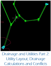
Drainage and Utilities Part 2
Initial Network Layout
This series covers the initial layout of the drainage network.
Drainage and Utility Network Layout - Check the Model
Drainage and Utility Network Layout - Structures
Drainage and Utility Network Layout - Conduits
Drainage and Utilities Best Practices
The following items are best practices when using Drainage and Utilities
- It is best to keep different hydraulic networks in different files in order to minimize data loss in the event of file corruption. This does not apply to very small networks
- Do not snap to anything when placing nodes. This often leads to additional crashes of the software
- Node elevations should refer a terrain model for their elevation.
- While it is possible to use a roadway mesh for the elevation, this is not the best practice as the roadway mesh cannot read terrain information beyond its own limits
- Use Civil AccuDraw to place nodes with precision at a particular station and offset. This creates element manipulators for dynamic editing when changes to the network occur
- Use scenarios to quickly analyze different design storms or inlet capture options in accordance with the MDOT drainage manual