Difference between revisions of "Drainage and Utilities"
| Line 60: | Line 60: | ||
There are certain conditions in which Drainage & Utilities software is not approved for use. These are: | There are certain conditions in which Drainage & Utilities software is not approved for use. These are: | ||
| − | + | # Culvert Analysis | |
| − | + | # Watershed analysis using the SCS Method (drainage areas greater than 20 acres.) | |
| − | + | # Combining ditch (open) and storm sewer (closed) conduits in one network. | |
Refer to the MDOT Drainage Manual for design practices and/or software for these conditions. | Refer to the MDOT Drainage Manual for design practices and/or software for these conditions. | ||
Revision as of 08:22, 7 April 2023
Bentley Products
Drainage and Utilities Learning Path
-Dataset Coming Soon-


Course Overviews
Microstation Part 1
Drainage and Utilities Part 1
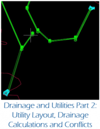
Drainage and Utilities Part 2
Initial Network Layout
This series covers the initial layout of the drainage network.
Drainage and Utility Network Layout - Structures
Drainage and Utility Network Layout - Conduits
Drainage and Utility Network Layout - Check the Model
Dataset Download - Network Layout.zip
Training Reference - ExTerrain.dgn
Training Reference - Survey 2D.dgn
Drainage and Utilities Best Practices
The following items are best practices when using Drainage and Utilities
- It is best to keep different hydraulic networks in different files in order to minimize data loss in the event of file corruption. This does not apply to very small networks
- Do not snap to anything when placing nodes. This often leads to additional crashes of the software
- Node elevations should refer a terrain model for their elevation.
- While it is possible to use a roadway mesh for the elevation, this is not the best practice as the roadway mesh cannot read terrain information beyond its own limits
- Use Civil AccuDraw to place nodes with precision at a particular station and offset. This creates element manipulators for dynamic editing when changes to the network occur
- Use scenarios to quickly analyze different design storms or inlet capture options in accordance with the MDOT drainage manual
Drainage and Utilities Guidance
In accordance with MDOT Design Advisory DA-2023-02, Bentley OpenRoads Designer Drainage & Utilities software, version 2021 R1 with the MDOT 10.10 workspace configuration, is approved for use on MDOT Trunkline projects, for design of enclosed stormwater systems and ditch capacity analysis. The workspace configuration has been customized to meet MDOT drainage standards.
MDOT flex tables that contain the assumptions and design parameters must be submitted as part of the Drainage Study. These MDOT flex tables have been set up in the workspace and are generated directly from the software.
Replace references to Geopak Drainage in Section 7.4.9.7 of the MDOT Drainage Manual with Drainage & Utilities.
There are certain conditions in which Drainage & Utilities software is not approved for use. These are:
- Culvert Analysis
- Watershed analysis using the SCS Method (drainage areas greater than 20 acres.)
- Combining ditch (open) and storm sewer (closed) conduits in one network.
Refer to the MDOT Drainage Manual for design practices and/or software for these conditions.
Special care should be used when storm sewers are found to be either in supercritical or pressure flow. Refer to Chapter 7 in the MDOT Drainage Manual or contact the MDOT Hydraulics resource listed in the left column.
Please refer to the following link for the Drainage & Utilities Guidance document: Drainage & Utilities Guidance Document