Drainage and Utilities
Bentley Products
Drainage and Utilities Learning Path
-Dataset Coming Soon-


Course Overviews
Microstation Part 1
Course Overview
Part 1 of the Microstation Connect Edition learning path is a self-paced Bentley Learn course that is available to all MDOT CADD users.
This course is a pre-requisite for all other MDOT learning paths
This self-paced Bentley Learn course covers foundational knowledge for use basic Microstation tools as a civil designer. For consultant designers with access to Bentley Learn, this learning path is very similar to the MicroStation CONNECT Edition Learning Path for Civil Designers which is available to all Bentley Learn subscribers. Topics covered include:
- Introduction to MicroStation Connect Edition
- Controlling the Display of Designs for Civil Designers
- Using General Tools in MicroStation Connect Edition for Civil Designers
- Drawing with MicroStation for Civil Designers
- Additional Drawing Tools
- Manipulating and Modifying Elements for Civil Designers
- Working with Cells for Civil Designers
- Annotating Designs for Civil Designers
Course Pre-Requisites: This course assumes no previous knowledge of Microstation. There are no pre-requisites for this course. This course is a pre-requisite for all other MDOT learning paths.
Estimated Time to Complete: 32 Hours
Drainage and Utilities Part 1
Course Overview
Part 1 of the Drainage and Utilities learning path is a self-paced Bentley Learn course that is available to all MDOT CADD users.
This self-paced Bentley Learn course covers foundational knowledge for use Drainage and Utilities tools that are included in OpenRoads Designer. For consultant designers with access to Bentley Learn, this learning path is very similar to the 09 - OpenRoads Designer - Drainage & Utilities learning path which is available to all Bentley Learn subscribers. Topics covered include:
- QuickStart - Navigating the Interface
- QuickStart - Evaluating Subsurface Utilities in OpenRoads Designer
- Drainage Layout and Design
- QuickStart - Laying out a Drainage Network in OpenRoads Designer
- Hydraulic Analysis and Design in OpenRoads Designer
- Managing Multiple Scenarios CONNECT Edition
- Dynamic Analysis - SWMM CONNECT Edition
- Ponds - A Physical and Hydraulic Introduction
- Detecting and Managing Utility Conflicts CONNECT Edition
- Creating Utilities from Graphics in OpenRoads Designer
- What Happens When You Place a Pipe
- What Happens When You Place an Inlet
- What Happens When you Hit Compute
Course Pre-Requisites: This course assumes a working knowledge of basic Microstation functions. Users should review and complete the following courses prior to taking this course:
- Microstation Connect Edition Part 1 (Available to MDOT Employees via Bentley Learn)
Estimated Time to Complete: 16 Hours
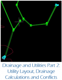
Drainage and Utilities Part 2
Course Overview
Part 2 of the Drainage and Utilities learning path is an MDOT developed course that can be completed either self-paced, or in-person as classes are offered by MDOT. This course is compatible with the versions of OpenRoads Designer and the MDOT Connect Workspace that are currently in production at MDOT.
This course covers foundational knowledge for using Drainage and Utilities on MDOT design projects. Topics covered include:
- System Layout
- Checking the Model
- Editing the Model
- Spread Calculations
- Conduit Calculations
- Reporting
- Clash Detection
Course Pre-Requisites: This course assumes a working knowledge of basic Microstation and Drainage and Utilities functions. Users should review and complete the following courses prior to taking this course:
- Microstation Connect Edition Part 1 (Available to MDOT Employees via Bentley Learn)
- Drainage and Utilities Part 1
Estimated Time to Complete: 8 Hours
Initial Network Layout
The 1 series shows how to use the existing information from the survey RID files.
Drainage and Utility Network Layout - Check the Model
Drainage and Utilities Best Practices
The following items are best practices when using Drainage and Utilities
- It is best to keep different hydraulic networks in different files in order to minimize data loss in the event of file corruption. This does not apply to very small networks
- Do not snap to anything when placing nodes. This often leads to additional crashes of the software
- Node elevations should refer a terrain model for their elevation.
- While it is possible to use a roadway mesh for the elevation, this is not the best practice as the roadway mesh cannot read terrain information beyond its own limits
- Use Civil AccuDraw to place nodes with precision at a particular station and offset. This creates element manipulators for dynamic editing when changes to the network occur
- Use scenarios to quickly analyze different design storms or inlet capture options in accordance with the MDOT drainage manual